
If you like cycling data and are curious about any of the trips I’ve done so far, this post is for you. I am by no means even an amateur randonneuring cyclist, but I have tried to push my own boundaries during the last month or so. I still have some big days coming up, particularly in Denmark in late July, so I will continue to ride in the afternoons and on the weekends here in the local area, aiming for riding steadily for 4 hours at a time. This following trip data does not include distances shorter than 12 miles or so, which I just count as riding around town.
Trip 1: Zurich to Zug. (CH) 12 June. (No map available)
- Distance: 37-40 miles?
- Time: 4 hours. I spent way too much time in Zurich. Cities generally slow me down a bit, and it’s important to have a good sense of exactly where to go. Not having access to GPS, a good map is invaluable to me. This was my first trip out of the airport, and I didn’t track it with Runkeeper, so my data is incomplete.
Trip 2: Brienz to Frutigen. (CH) 13. June.
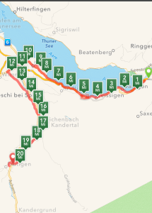
- Distance: 20.81 mi/ 33.49 km
- Time: 2 h 39 m
- Elevation change: 2,843 ft/ 866 m, primarily level to uphill.
Trip 3: Adelboden to Wangen an der Aare. (CH) 14 June. This trip was divided into two stretches, but I’ve combined the data into one trip.
- Distance: 70.22 mi/ 112 km
- Time: 6 h 57 m
- Elevation: 3,413, mostly downhill and then fairly level.
Trip 4: Freiburg to Titisee. (D) 21 June
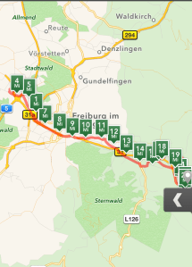
- Distance: 24.70 mi/ 39.7
- Time: 3 h 8 m
- Elevation: 2,055 ft/ 626 m, level and then generally uphill.
Trip 5: Titsee to Freiburg (D) 21 June.
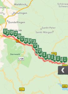
- Distance 22.26 mi/ 35.82 km
- Time: 2 h 33 m
- Elevation: 2, 153 ft/ 656 m, almost entirely downhill and then level.
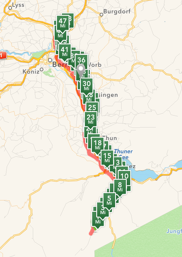
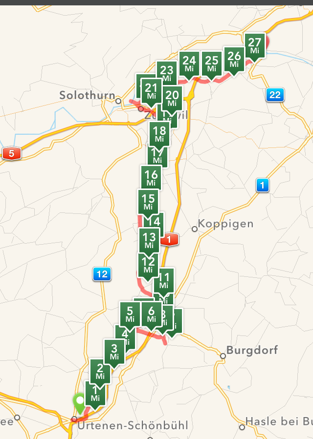
Trip 6: Freiburg to Basel (primarily D, but a little in F and CH), 27 June.
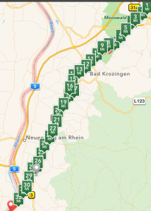
- Distance: 33.1 mi/ 53.26 km
- Time: 3 h 23 m
- Elevation: 1,432 ft/ 436 meters, fairly level with one high point across a vineyard on a hill, then following the Rhein southwards.
Trip 7: Pleigne to Pleigne loop, via the Swiss/ French border. (CH/F) 30 June. I got lost in a pasture on a mountain and had to convert from mountain biking to hiking for a bit, so again the data is skewed, especially the time.

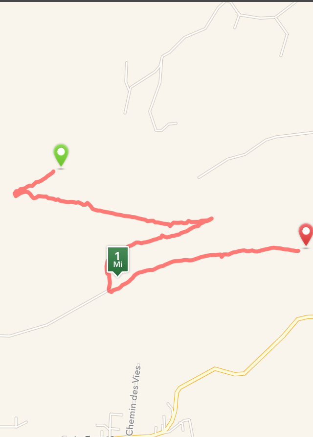

- Distance: 21.83 mi/ 35 km
- Time: Too long. 2 h 24 m, plus 44 m, plus another 57 minutes. With bramble scratches.
- Elevation: 2,158 ft/ 657 m, mainly downhill, then 638 ft/ 194 m of wandering around on the mountain, then 891 ft/ 271 m of downhill and then uphill again.
Trip 8: Pleigne to Pleigne loop, via Delemont. 2 July. (CH)

- Distance: 24.32 m/ 39 km
- Time: 2 h 56 m
- Elevation: 2,310 ft/ 704 m, with a big downhill, fairly level in Delemont, and then a big uphill push back to Pleigne.
Cycling in the Jura with a starting point on the top of a mountain means that you always start with a really fun downhill ride, but coming home is a big push. It’s 12 Swiss Franks to take the bus from Delemont to Pleigne, in addition to the humilation of having to take the bus home. So I’m experimenting with finding the most enjoyable loop. I’ll be heading out again tomorrow.
